Rocky Mountains
Used with permission. © Kaitlyn Guenther
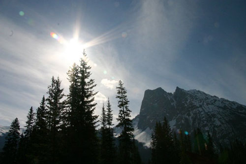
The Rocky Mountains are my favourite place in the entire world! I grew up only an hours drive away from the magnificent peaks and valleys, and every summer I spent weeks hiking the mountains and paddling the rivers. There are so many different activities during the summer and the winter; the Rockies are great for family bonding and friendly adventures. Some of my best stories and memories come from the Rocky Mountains!
Location:The Rocky Mountaians cover approximately 3,000 miles and stretch all the way along western North America—from Alaska all the way down to New Mexico. The Rocky Mountains extend into eight states, two provinces, and two territories. Interestingly, the Rocky Mountains encompass over 100 separate mountain ranges rather than one range.
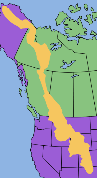
The Rocky Mountains form the Great Divide; since the peaks reach so high, water runs towards the Pacific Ocean on the western side of the Rockies and towards the Atlantic and Arctic Oceans on the eastern side.
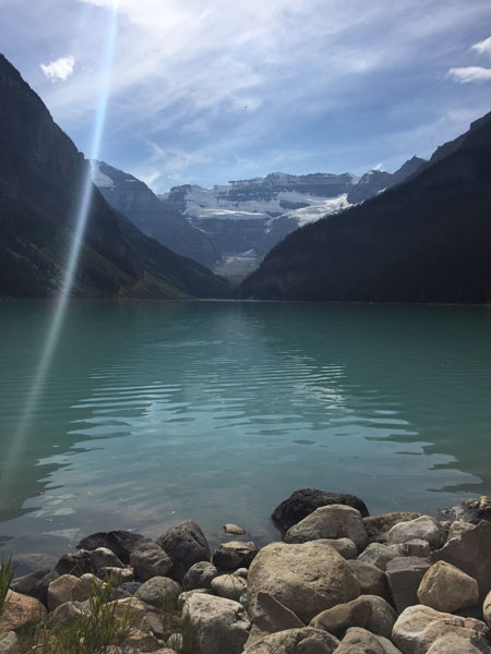
Used with permission. © Kaitlyn Guenther
Landscape and Topography
Since the Rocky Mountain region is so large and runs through so many different areas it is often split into five sections. From top to bottom the sections are: Brooks Range, the Rocky Mountain System of Canada, Northern Rockies, Middle Rockies, and finally Southern Rockies. The inclusion of the Brooks Range in the Rocky Mountains is often debated, however, we have chosen to include it in our information despite it's differences from the other sections of the Rockies.
Brooks Range:
The tallest peak—Mt Chamberlain—in the Brooks Range is 2,749 meters above sea-level. The Brooks range creates a sort of border between the arctic region and interior region of Alaska.
The Kobuk River runs through part of the Brooks Range for about 280 miles across the mountains and plateuas of the mountain range. The Kobuk River drains into Bering Straight, meaning that it flows to the western side of the Great Divide.
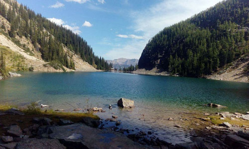
The Rocky Mountain System of Canada:
Used with permission, © Kaitlyn Guenther
Mount Robson is the tallest peak in the Canadian Rocky Mountain system, reaching 3,954 meters above sea level. There are several other impressive mountains in this section, like the first glacier-hung peak north of the U.S. border—Mount Joffre. Snow Dome, although it isn't incredibly tall based on Rocky Mountain standards, is really cool. This particular mountain has water flowing in three different directions from it's peak, into the Pacific, Atlantic, and Arctic oceans.
The Rocky Mountain Trench seperates the main geological body of the Canadian Rockies and the additional Columbia Mountain group. The Rocky Mountain Trench drains into several of the main rivers, such as the Peace River, Kootney River, Fraser River, and Columbia River. Other notable rivers in the Rocky Mountains of Canada are the Bow, the Athabaska, and the North Saskatchewan rivers.
Northern Rockies:
Of all the segments of the Rocky Mountains the peaks in the Northern Rockies tend to be shorter; the tallest peaks—Borah Peak (3,857 meters) and Leatherman peak (3,728 meters)—can be found in the Lost River Range.
Interestingly, it is from this segment of the Rocky Mountains that two of the regions most well known trenches originate. The Rocky Mountain Trench develops from Flathead Lake and the Purcell Trench extends from Coeur d'Alene Lake.
Middle Rockies:
The mountains of the Middle Rockies appear quite abruptly in the plateuas of Idaho and Wyoming; there are no foothills to build up to the steep mountain crests. The tallest peaks found in the Middle Rockies are Gannett Peak (4,202 meters) and Grand Teton (4,196 meters).
Southern Rockies:
The highest peak in this section of the Rockies is Colorado's Mt. Ebert, which reaches 4,399 meters above sea level. Mt. Ebert is only the 31st tallest mountain in the world and the peak can be reached without significant mountaineering skills, even by bicycle. Mt. Ebert also happens to be the tallest peak in all five segments of the Rocky Mountains.
Climate:
In the Brooks Range the average summer temperature is 3°C and the average winter temperature is -26°C. In the summer months there is plenty of sun, which allows for lots of vegetation growth. Due to the tilt of the earth, there is approximately 80 days during summer months, where the sun never dips below the horizon. All of this sun still doesn't allow the ground to thaw more than a few feet. Precipitation falls mainly in the form of snow, especially in the eastern stretches of the range and, of course, at the higher elevations and mountain peaks. The Brooks Range recieves between 75 and 130 centimeters of snow annually, which is significantly lower than the other mountain ranges in Alaska.

Used with permission. © Darren Guenther
The Rocky Mountains of Canada experience extreme weather. Temperatures and climates change based on elevation as well. For approximately every 1,000 meters of elevation there is an approximate drop of 5°C. It is also interesting that the Rocky Mountains split the coastal climate of British Columbia and the dry climate of Alberta. The coldest winter month is January, which can commonly reach temperatures of -30°C; although, usually the winter temperatures fall around -10°C. The region tends to get consistent snow from November to March; however, there is occasional snowfall from August to May as well. The summer months, although short, are very warm. Each summer month typically has the most precipitation in the form of rain, recieving around 50mm of rainfall in each month. The hottest month is July where temperatures can reach higher than 30°C. Many find that the hot temperatures are made more bearable by the dry climate.
Extending into the American segments of the Rocky Mountains, the northern most parts of the Rockies experience similar temperature and precipitation patterns as the Canadian Rockies. As you move south from the border there is less precipitation; for example, Colorado and New Mexico tend to be drier and more arid. Some areas are even desert-mountain reasons and contain rain-shadow valleys, which limit the amount of precipitation even further. Thunderstorms in the summer months are very common throughout the Rocky Mountains, but especially moving into the Middle and Southern Rockies. It is also very interesting that in the Southern Rockies around 75% of the precipitation falls on the west side of the continental divide, this is similar to the pattern in the Canadian Rockies. The annual temperature in the Southern and Middle Rockies falls around 2°C to 7°C, but of course this is also affected by the elevation and the seasonal changes, meaning it will be colder in the winter and higher up.

Plants and Animals:
The Rocky Mountains can be a difficult region to inhabit, with the climate and the elevation, but regardless there are lots of animals—large or small, mammals or birds, herbivores or carnivores.

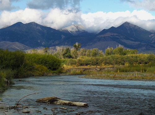
Used with permission. © Darren Guenther
On a hike it is common to see some smaller animals like squirrels and chipmunks. However, on a quieter routes or during specific times of year there is also a good chance you might come across a black bear. Spotting a grizzly bear is less likely, but still possible especially if you're roaming a less densely forested area. Cougars (also known as Mountain Lions) are very rare predators to see and probably one of the most dangerous in the Rockies.

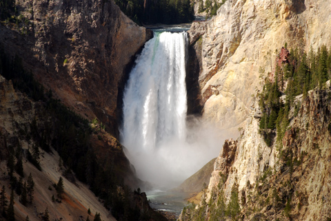
Used with permission. © Darren Guenther

Used with permission. © Darren Guenther
In the spring and early summer seasons the Rockies are full of wonderful wildflowers. The wild rose (also Alberta's provincial flower) is abundant in the mountain ranges. The crimson paintbrush has brilliant red petals filled with a sweet nectar, that even humans can get to. Bluebells, Canadian goldenrods, oregon grapes, and western wood lilies also add splashes of color to the trails of the Rocky Mountains.

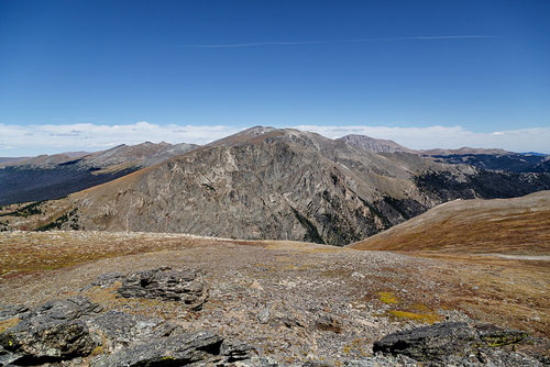
Used with permission. © Darren Guenther

Used with permission. © Darren Guenther
Used with permission. © Darren Guenther
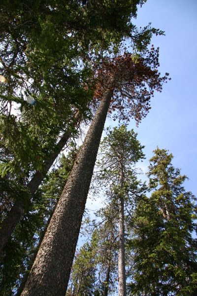
At the southern point of the rockies the tree line is at it's highest elevation of 3,660 meters. However, due to the presence of more basins and plateaus in the mountain ranges of the USA Rockies, there tend to be less trees except around streams.
Human Presence:
Human establishment in the Rockies has exhisted far back into history. Indigenous groups of the Rockies have managed to inhabit the harsh climate and steep elevation of the Rockies for years. The Stoney or Nakoda tribe in the Canadian Rockies is a very well known tribe with rich culture. The Nakoda tribe even helped to establish outdoor camps so that children could experience the Rockies in a natural sense. The "Great Basin" indigenous peoples of the Southern and Middle Rockies are a very distinct culture of Aborginal Peoples.
There are many explorers that have passed through the ranges of the Rocky Mountains. Some of the more famous explorers that passed through American ranges of the Rocky Mountains were Meriwether Lewis and William Clarke from 1804-1806, Benjamin Bonneville from 1832-1835, and Ferdinand Hayden in 1871. Sir Alexander Mackenie passed through the Canadian regions from 1792-1793 followed by exploreres like David Thompson and Simon Fraser. These explorers set the foundation for pioneers to develop towns and settlements in the Rockies. In areas around the Rcoky Mountains there is evidence of pioneers and indigenous groups in cave paintings and rock carvings.

Mining towns were very popular in the early years of settlers. The Rocky Mountains had an abundance of mining opportunities, so towns popped up all across the region. In Alaska the miners focused on petroleum where as in Canada copper, lead, and zinc drew miners to British Columbia and coal drew miners to Alberta. Travelling south there was an abudnance of silver, iron, and more copper. In the Middle and Southern Rockies more petroleum could be found along with natural gas and coal. Oil shales in Wyoming are also very valuable and drew a large portion of the miners.


Used with permission, © Kaitlyn Guenther
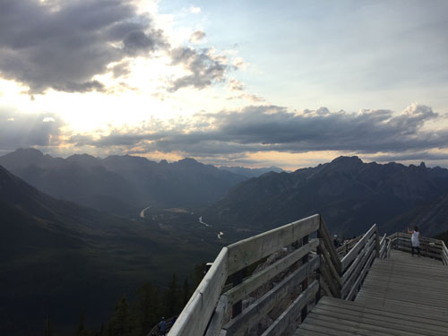
Nowadays there are several towns and a few small cities through out the mountain ranges. For instance, Banff is actually the highest elevated town in Canada, resting at an elevation of 1,383 meters above sea level. Some of the small cities in Canada also include Kelowna, Kamloops, and Prince George. The areas of the Rockies that reside in Montana are abundant with the cities Missoula, Helena, and Butte. There are also cities in New Mexico (Sante Fe) and Wyoming (Casper).
The Rocky Mountains are abundant with tourist attractions because of the incredible wilderness experience and outdoor activities. In the winter skiers and snowboarder from all over the world make the Rocky Mountains their destination. People looking for more obscure winter sports can try snowshoeing or even dog sledding. Winter camping is an option for those who aren't afraid of the cold and well prepared, yet summer camping is incredibly common in the Rockies. Some people choose to backpack to their campsite while others drive and set up tents or motor homes. Water sports like kayaking, paddle boarding, and canoeing are very popular and their are many rental and tour companies that take people on excursions. Hiking is also very common and a very active way to explore the mountains.

As you drive along the highway through the Rocky Mountains you can see overpasses that appear to be covered with nature—grass, shrubs, and trees. These overpasses are areas where animals can cross over the highway; since the human influence in the Rocky Mountains is so great, habitats of wildlife are strongly impacted.

Used with permission, © Kaitlyn Guenther
Worksheets and Other Activities:
- Forest Animal Crafts and Activities (from dltk-kids.com)
- Rocky Mountain Coloring Pages (from coloring.ws)
- Glacier in the Rocky Mountains On-Line Jigsaw Puzzle
- "What I've learned about the Rocky Mountains" Coloring Worksheet
- Summit Mt. Ebert Maze
- How many words can you make from ROCKY MOUNTAINS
Word Worksheet